Wednesday 28 July 2010

Sun 20th June 2010 - Leg14 : Hare Street to Royston - 12.7 miles

It was the beginning of the end when Jim Web, Jonathan Berks, Sandra Scott, Linda Berks, Liz Beardwell, Ray Munden, Pat Fletcher, David Beardwell, Neil Guttridge, Howard Peacock, Fudge (the dog), Chris Hardy, Guy Garfit, Ginny (the dog) lined up in front of the Old Stores in Hare Street for the now customary group photo.

It was a cool but humid morning as all, except Jim, set off on the first short stretch to St Nicholas Church, Great Hormead. Jim had stayed behind just in case any members of the public decided to join us - we had arrived in Hare Street much earlier than the publicised start time and were itching to get going. We were also expecting the Warden for this stretch of the walk, Ian Hurst to join us and Jim had to wait for him.


We sat or walked around the churchyard amusing ourselves until Jim and Ian arrived. Off we set in earnest. Along pathways, across a meadow and down a narrow path onto the road in Great Hormead. As usual we turned in a direction so as to avoid the nearest pub.

We followed the path blindly until Ian shouted, “Left turn!” just as we were about to walk up the drive to Hormead Hall! With a screech of brakes (just imagine it) we turned left. Our route eventually brought us out in the village of Anstey and to the Church of St George. Here we had a break for coffee.


It so happened that we had arrived on the day of a service to commemorate the loss of ten American air crew, killed when their bomber crashed behind the church shortly after take off from nearby Nuthampstead airfield during World War II. The incident was described to us by one of the Church Wardens as he waited for two veteran US Airmen to arrive for the service. There is a stained glass window in the Church to commemorate the airmen.


We left the churchyard and continued our walk through the village, past the Blind Fiddler Pub, recently renamed after a local blind fiddler who, local legend has it, walked back to the cave in which he lived, fiddling all the way. After entering the cave the music suddenly stopped - the fiddler was never seen again.


Continuing on, we passed the old village pump and eventually entered the aforementioned Nuthampstead Airfield where we crossed the main runway. We were told by Ian that the hard core used to build the runway came from a demolition site in London then, when the M1 motorway was being built the runway was broken up to provide hardcore for the motorway - that’s recycling!


Onwards, across the airfield, to the Woodman Inn for lunch. Outside the Woodman is a memorial to the USA 398th Bomb Group which was based at Nuthampstead during WW2. Here we were joined by Ken and Di Charles but, unfortunately, Liz Beardwell had to leave for another engagement.


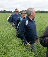
After lunch we were again on our way - the longest part of the day’s walk lay ahead. After negotiating several bridges, kissing gates (no more demonstrations by the Berks!) and other obstacles our path took us across a field of oilseed rape, more than waist deep for some of our party.


In due course we found ourselves wondering down Barkway High Street. Barkway, once a coaching stop on the road from London to Cambridge is now famous for its Street Market and Village Pantomime. We stopped for a breather by the village pond. Moving on, further up the High Street we turned left into Church Lane, our path the taking us through the churchyard and hence onto the village of Reed where we emerged close to the Cabinet pub, despite the temptations we soldiered on to the village church where we again took a breather.

 A lovely little church where, we noted, one of our Club members is a Church Warden. After lazing in the sun, we walked on through the village to emerge on the Joint, the road running between the A10 and Barkway. We crossed the Joint and took a path across the fields, vaguely in the direction of Royston.


At its highest point we had a splendid panoramic view across towards Cambridge, the Fens and Ely. With Ray’s binoculars we were just able to make out Ely Cathedral.


As we walked into a dip, the sea of blue before us turned into a field of linseed. On past a new “farm-hand’s” house and a large array of sheds and farm machinery. It’s amazing what is within a mile or so of your own home that you didn’t know about. We walked up the other side of the dip to the top of the chalk escarpment that borders Royston, then down through the woods to the bottom of the Grange Estate, out onto Barkway Road, down the hill to Priory Gardens, the churchyard and our final goal, the Cross. The End.


Chris Hardy


Sat 19th June 2010 - Leg13 : Bishop's Stortford to Hare Street - 11.4 miles

It was a fresh and breezy morning when at 9.20am President David, the Diplomat, the Alpaca sheerer, Pharmaceutical Consultant and Construction Engineer left Bishop Stortford on the penultimate leg of the Polio+ walk. The town meanwhile was girding ups its loins for the annual Fete and Fun day.


Bishop Stortford dates back to well beyond the 11th century when Bishop Maurice of London built Waytemore Castle to oversee the very key position, the ford over the River Stort, for William the Conqueror. Wayte means place of ambush and more a fen or marsh. The ford was a troublesome spot before the fort was built.
 The town has two other people of great distinction. Cecil Rhodes of South Africa fame, who was born there, founder of the two Rhodesia’s and the owner of what was then the largest diamond mine in the world, Kimberley. It is still being mined to this day. The second Sir George Jackson opened the canal in 1769 and was a major shareholder in it. He was also a promoter of Captain Cook who later named Port Jackson in New South Wales and Point Jackson in New Zealand in his honour.

It was but a short walk from the station and down the high Street and through the playing fields to the countryside. The ground under foot was cracked and dry but despite the longish dry period we have had, the fields and hedgerows were verdant. The latter were peppered with blushing pink and white dog roses and there was an abundance of Elder Flowers which people were already starting to collect for Elder Flower cordial and wine. Judging from the sloes on the Blackthorn they did not suffer too badly from frosts.

After passing under the A120 we entered Hadham Park and soon reached the Hall. Hadham Hall is a Tudor building parts of which date back to 1575. It was once owned by the ancestors of the Earls of Essex. The 2nd Earl of Essex, Robert Devereaux, a favourite of Queen Elizabeth I suffered the fate of ambitious men of the time by being thrown into jail for his failure as a general in Ireland. He was later banished and finally beheaded on his return for leading a rebellion against her.

Outside the gatehouse you will find a boulder of pudding stone but no Crème Anglaise. Pudding stone is in geological terms known as a conglomerate and as such fairly rare. Hertfordshire Pudding Stone consists of well rounded flints and sandstone pebbles cemented together by a matrix of silica quartz. Similar stones can also be found in Essex. In cross section it looks like concrete.

The hall grounds are now an upmarket housing development and business park.

Our next port of call was Partmore Heath which has an outstanding area of grass heathland and as it is such a scarce habitat in the south east is a SSSI. It’s the heath has a number of rare plants and its ponds are the home for thee forms of newts including the locally rare palmate newt.

Lunch was taken after 6.2 miles at the Catherine Wheel in Gravesend where we arrived at 11.30 am. The hospitality of the house was first class and both the food and drinks were reasonably priced.

The afternoon stroll to Hare Street was unfortunately spoiled by a few short sharp showers, none of which got us a wet as having to fight our way along a previously cleared path through chest high oilseed rape. Under the weight of the seed it had bowed over to cover our route. Unfortunately the path had previously been trafficked by horses which made the ground below the rape dangerous underfoot.

In addition to the dog roses the hedge rows and field edges were covered with oxeye daisy, red and white campion, teasles, blackberry and many other flowers. The remnants of last months May could be found and their seeds were setting ready to feed the birds through the winter.

Along the way we saw many Burdock plants. In my younger days we used to enjoy the soft drink made from dandelion and burdock which has I believe has been drunk since 1265. Can it be found today? The root of the burdock also has many herbal uses. It seems, in the past, to have been used as a cure all being a cure for common colds, arthritis, sore throats etc. and it was taken as a diuretic and for purify the blood. In modern medicine it is use in oncology and also reputedly used to treat other serious health problems.

As we walked through Mutfords, we past a field full of post war vintage Austin and Rover cars.

We arrived at Hare Street at about 3.00pm having enjoyed yet again a great day out in the Hertfordshire countryside.

Jim Webb


Approaching Little Hormead


Sunday 6 June 2010

Sun 16th May 2010 - Leg12 : Widford to Bishop's Stortford- 13.6 miles

Our journey commenced in the delightful village of Widford, in the Ash Valley, it was here that our party of David Izod – leader for the day – Linda and Jonathan Berks, Chris Hardy, Fudge and myself were joined by another Linda and her husband Hugh, from the Rotary Club of Epping. They live in Hertford and walk the Hertfordshire footpaths regularly.

After the walks further south in the county, we have now reached East Hertfordshire, described as an area of small villages and large fields.
Leaving Widford behind and moving up the Ash Valley, we head out across the fields, passing Mill Wood, towards Much Hadham.
Before we see anything of this picturesque village, we are directed onto one of the now familiar Hertfordshire Way loops – named the Much Hadham loop. It turned out to be much too obvious, as we came across a junction where the Hertfordshire Way branched off in three directions. We knew by going straight on we would eventually return to this point to take the third option later, and so it proved to be.

However, straight on we went, into Sidehill Wood. Very apply named as the path was cut into the side of the hill. In a large part of this wood the Bluebells were in full bloom, covering the ground with a carpet of blue. A wonderful site to behold.

Leaving the wood behind we crossed a field to the River Ash at a point where the road goes across through a ford. We were not to cross yet, as we were directed through a one hundred and seventy degree turn back up the road before turning off left across the fields.

Eventually, after a further two miles, we crossed the river further downstream and continued on across the fields, eventually arriving at St Andrews Church in the village of Much Hadham. This church is reputed to have two gargoyles carved by Henry Moore, the sculptor. Time didn’t allow for us to view these interesting spectacles, a further visit will have to be made another day.

As we joined the High Street in the village, we met up with another charity fundraiser, Mats Frankl from Sweden, who is roller blade skating round the world in aid of the Red Cross. He commenced his feat at the top of Mount Are in Sweden, has roller blade skated though Sweden and Norway before crossing to the UK, landing at Edinburgh. He has travelled down this country, and stayed over the previous night at a B & B in Hare Street; he will be in London the same day that we met him. Staying that night in Stoke Newington before heading for Harwich, where he crosses back onto main land Europe. Then on through Denmark, Belgium, Germany, France and Spain. From Spain he travels across the Atlantic to North America. He told us he travels approximately 50 miles each day. His endeavours are reported daily on his web site - http://www.rollerpeace.com/ . He is accompanied by his wife and two young sons, who follow behind in a camper van. Good to meet someone with a purpose in life, I wonder what made him start this venture. If you visit Mats’ web site and click on Photos then Supporters, you will find a photo of us with Mats.
After we had all taken the inevitable photos, Mats wheeled away ahead of us down Much Hadham High Street on his way to London. We followed in the same direction but at a far more sedate pace.

We walked half way down this very pleasant village, with its period cottages and houses, before stopping outside the village hall for our morning coffee break. After coffee we continued on down eventually turning off left by the Old School House, with its flint stone walls.

It was not long before we came across the same river again, this time back at the road and the ford. We were now the wrong side, but a foot bridge had been provided, so all was well, except that there is always one who has to wade through the water!!!!!
Once on the other side, the route retraced our tracks back across the field and into Sidehill Wood again, with its display of Bluebells. So, back at the signpost we resume our walk taking the third option. It was now out into the country again, across fields toward the village of Perry Green.
It was here in Perry Green that Henry Moore came to live during the Second World War, and remained until his death in 1988. Before entering the village we passed through the Henry Moore Heritage Foundation Trust, where many examples of Moore’s work are displayed around the grounds. They say art is in the eye of the beholder!!!!!
Passing through the very pretty village of Perry Green, we cross more of Hertfordshire’s countryside in the direction of Tye Green. Here we found a hostelry for our lunch break. The Prince of Wales is a pub that hasn’t changed much over the last thirty years. It has a varied collection of real ales as well as snacks. The gentlemen of the village were in there for a sociable drink rather spending large amounts of money on expensive food. However, our Linda did find the chips were of a very high standard.

After a well deserved break, we walked on towards Thorley and our final destination of Bishop’s Stortford. Continuing on through fields with beans, corn and rape we arrived at the London/Cambridge railway line. It was crossed with care, even for a Sunday it was busy. Once over that hurdle we arrived on the banks of the River Stort, more a canal than a river.
Turning left up the towpath towards Tyeford Lock. It was here that a dilemma had to be addressed. To the end of the journey via the streets of Bishop’s Stortford following the Hertfordshire Way route, or following the more pleasant route along the river. This alterative was meant to cross the county boundary into Essex.
We decided to take the picturesque route along the canal. I can categorically assure any one following in our footsteps, that Essex wasn’t in our way, and we saw no “Essex Girls”.
The towpath eventually arrived at the end of the canal on the outskirts of Bishop’s Stortford and only half a mile from our final destination, the railway station.

So ended a very pleasant day’s walk though some spectacular countryside, we are indeed fortunate to live in such a beautiful part of the world.

Howard


Sat 15th May 2010 - Leg11 : Hertford to Widford- 13.6 miles


Brilliant sunshine heralded a warm day with occasional cloud cover and no rain! David & Liz Beardwell, Guy Garfit and Ginny four legs, David Izod and, of course, Jim Webb set off from Hertford Parliament Square on this 11th leg. Passing over the river, excellent views of ancient buildings and the impressive McMullen’s Brewery were passed, before leaving residential Hertford for a raised course, bordering Goldings Canal, once an essential supply of the town’s drinking water.
Climbing gently we followed the river Beane valley in company, at a distance with the Hertford-Stevenage railway and main road. Bluebells were a feature here in the rising woodland to our right. Passing Waterford and leaving the railway on our left we encountered Stapleford church, a well preserved rendered building, although we struggled to view the ancient Norman gateway. Further up the Beane we heard our first waterfall, an impressive triple at Bullsmill. Crossing open country in Woodford Park, we enjoyed some longer parkland views with excellent tree specimens.


Ginny the dog was restrained early here, passing through a large flock of somewhat sinister sheep. They only moved marginally to let us through and then formed up facing us in rows, staring. Liz and I were bringing up the rear where they had closed up behind us.As I approached, one of them singled me out and took two paces towards me. Not wishing to distress the animal unnecessarily, Liz and I ran for the nearby path gate and hurried through, only to see the herd fill the closed gate entrance with pressure, one animal actually squeezing through the metal bars! We hastened on, no pursuit taking place, but the herd remained pressing into the gateway. I had never witnessed this almost aggressive behaviour by sheep before and Ginny hadn’t said a word!


Our way took us in sight of the impressive Woodhall Park House before turning away and climbing towards the park boundary wall crossing by stile where ancient step stones were in evidence. Traversing along the wall we eventually crossed the A602 and climbed through woodland to high ground past a water tower. More open country and occasional copses and farm houses led us almost suddenly down into the Rib valley at Wadesmill. Sitting in the peaceful pub garden of the Anchor at lunch, by the once dangerously busy A10, I reflected how quickly the atmosphere of perhaps one hundred years ago had returned, after the by-pass construction.


Mostly restored we left the village, passing several buildings of interest, up hill and along the valley side. We found the tower of a ruined church, delighted to see a scaffolding team cladding the building. Restoration or maybe H&S, but still work was being done and it wasn’t demolition! The path flirted with the riverside for a while until we spied a trusty Hertfordshire way sign (many of which were missing on this stretch), pointing across a treated gap in an Oilseed Rape field.


Being conscientious walkers we duly kept to the path only to find that the plants had been sprayed late when virtually full grown. They seemed to resent our passing, and the path was a lot longer than first perceived. Being in the van of our group my body hugging walking trousers became stained with pollen dust and highly unattractive…The alternative almost parallel lane is highly recommended! The path, now seriously uphill, flattened, at last, and led us eventually steeply down into Wareside. A well earned break was taken, outside the closed White Horse (probably as well) before the last lap to Widford.

Although, after twelve or so miles, I was flagging a bit, this next section of the walk was probably the most beautiful with excellent long Ash Valley views, and Widford Church a now welcome final highlight. A short road walk triggered a fond memory for me of the approach to Buxton Derbyshire, with industrial units tucked away in a long wooded quarry. Old railway lines, whilst saddening, can still set my imagination off on a reverie of what life was like in their heyday. Somewhat cruelly for the weary, Widford Church comes close after thirteen miles only to be whipped away on our right as we are tantalisingly drawn up the valley for the best view ,Good oh! Seriously it was a lovely view both of the Church approach and back down the valley from some charmingly challenging steps. Destination at last and our trusty vehicle back to Royston. The best leg I have been on and in the best weather. Ginny the dog snored on the way back...and we all knew why….

David Beardwell

Saturday 1 May 2010

Sun 25th April 2010 - Leg11a : Broxbourne to Hertford - 12.5 miles

It was a good turn-out with Sandra Scott, Jonathan & Linda Berks, Barbara & Peter Mitton, Howard and Fudge Peacock, Ray Munden and David Izod lulled into a false sense that the weather would be fine following the brilliant day that we had enjoyed on Saturday. Surprise, surprise it rained!


Most of the walk was along the New River, which continues to be a major supply of water into London, and the River Lea Navigation with a brief diversion into the Ash Valley to get the obligatory mileage in. We started at Broxbourne Station and after a couple of miles reached Rye House Station, close to the scene of The Rye House Plot of 1683 which was a plan to assassinate King Charles II of England and his brother (and heir to the throne) James, Duke of York, builder of Peter Franks’ palace. Historians vary in their assessment of the degree to which details of the conspiracy were finalized. Anti-Catholic sentiment, which associated Catholicism with absolutism, was widespread, and focused particular attention on the succession to the throne. While Charles was publicly Anglican, he and his brother were known to have Catholic sympathies. These suspicions were confirmed in 1673 when James was discovered to have converted to Catholicism. Rye House, a manor house owned by a well-known Republican, Richard Rumbold was to conceal a force of 100 men in the grounds and ambush the King and the Duke on their way back to London from the horse races at Newmarket. However, because there was a great fire in Newmarket on 22 March, which destroyed half the town, the races were cancelled, and the King and the Duke returned to London early. As a result, the planned attack never took place. Historians have suggested the story of the plot may have been largely manufactured by Charles or his supporters to allow the removal of most of his strongest political opponents. Politics always was a rough old trade.

At Stanstead Abotts we passed the Clock House. From 1635 it housed a grammar school founded by Sir Edward Baesh, which subsequently closed in 1881 and is now a residential property. The town is also famous for fishing and was recommended by Izaak Walton in his book, “The Complete Angler”.

We walked up the Ash Valley, back through Easneye Wood, along the disused railway line to Buntingford, axed by Dr Beeching in 1965 and back to the sand and gravel pits at Amwell. In doing so we managed to lose our ladies who had stopped to take pictures of the wildlife conservation area and got left behind. Whilst searching for them, Howard found a sign post saying Hertford 2 1/4 miles, but of course the planners had other routes in mind for us, giving us well over 5 miles further to walk!

After being reunited we continued on across the railway and the New River to the church of St John’s built in the 11th century and much restored. Peter and Jonathan were confined to the stocks there but we were too polite to throw rotten eggs at them! We enjoyed a well earned pint at the George IV pub. Stirring our stumps we passed by the monument to Sir Hugh Myddleton, builder of the New River near to Emma’s Well close to one of the springs that feeds the New River.

Continuing along the New River and the Lee Navigation tow path we eventually turned up at Ware passing by the Gazebos. These were erected by the Ware inns to attract new trade following the setting up of England’s first turnpike road which then as now caused all the traffic to find an alternative free route and had had a disastrous effect on their business!

I had not realized how interesting Ware and later when we got there, Hertford, are. We tend only to see the main street and miss all the older nooks and crannies. Anyway, somewhat footsore but pleased with our accomplishment we finished our walk at around 4 pm in a nice, pleasant afternoon at Parliament Square.